dimensional compliance analyses
Throughout my work at JM Goldson LLC, I have conducted multiple dimensional compliance analyses to assess whether parcels meet the minimum zoning requirements established by a municipality. This analysis helps identify lots that do not meet the minimum lot size and frontage standards, affecting their development or subdivision potential.
I conduct these studies using Geographic Information System (GIS) models that automate the evaluation process. These models isolate different zoning districts within the municipality and calculate key metrics to determine whether parcels comply with the required dimensional standards. This methodology provides a clear understanding of the regulatory status of land and supports the development of urban planning strategies and growth management policies.
What is a dimensional compliance analysis?
It evaluates whether parcels within a municipality meet the minimum lot size and frontage requirements set by zoning regulations. It helps identify which lots can be developed under current regulations and which may require adjustments or exceptions.
This analysis is essential for urban planning as it allows municipalities to understand land availability and constraints better. It helps design more effective zoning strategies, anticipate potential development limitations, and make informed decisions on densification, lot subdivision, and regulatory restructuring.
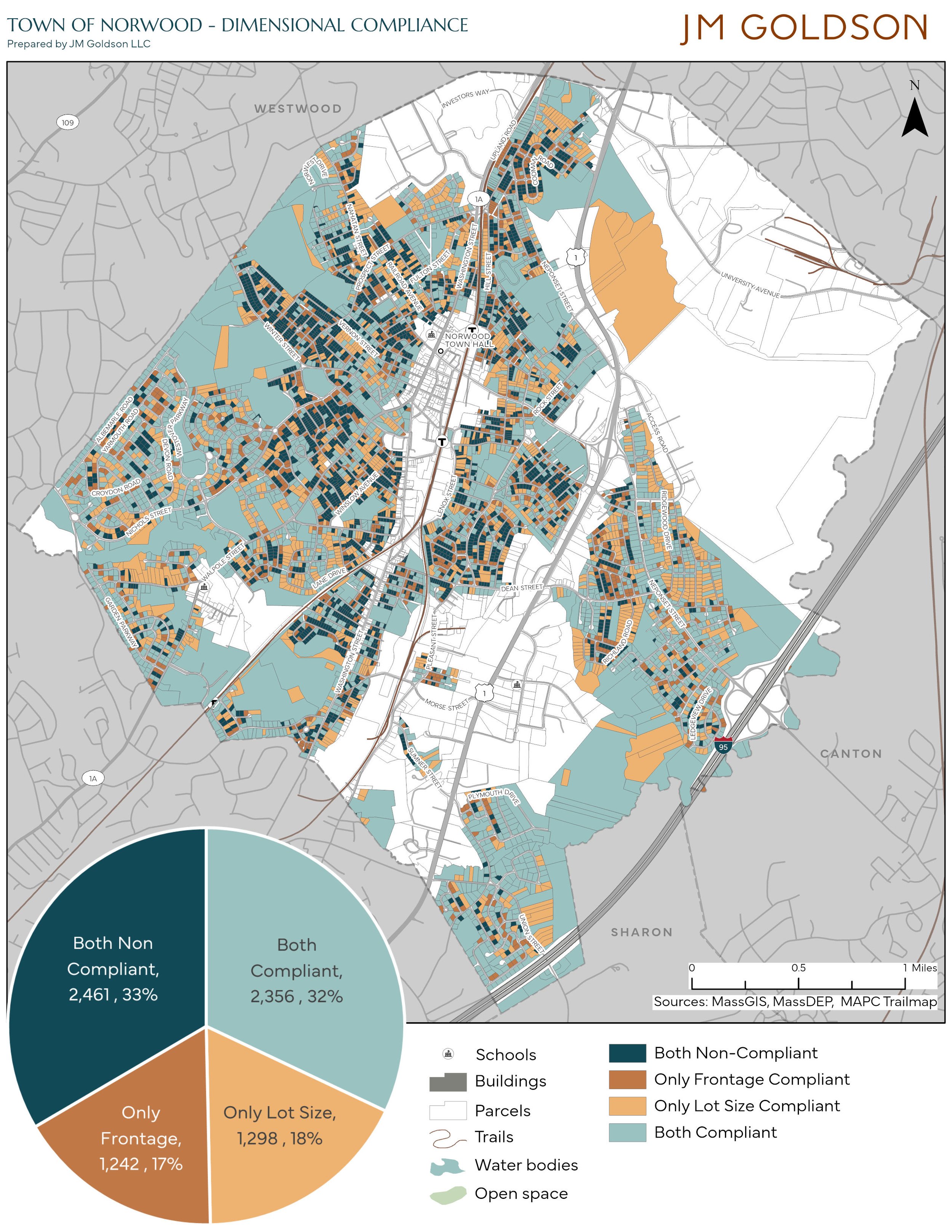
Dimensional compliance analysis of the Town of Norwood, MA
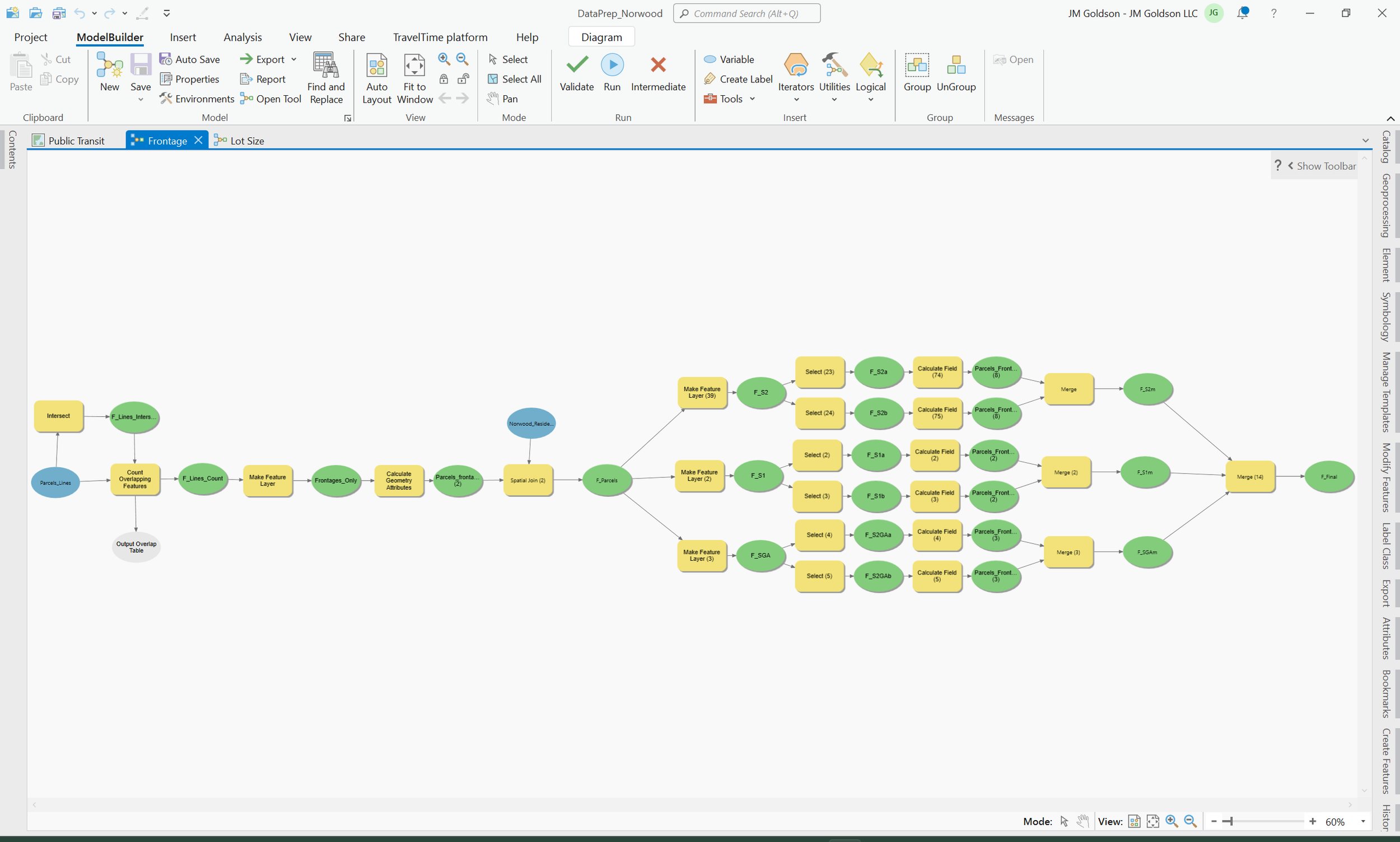
Minimum frontage GIS model
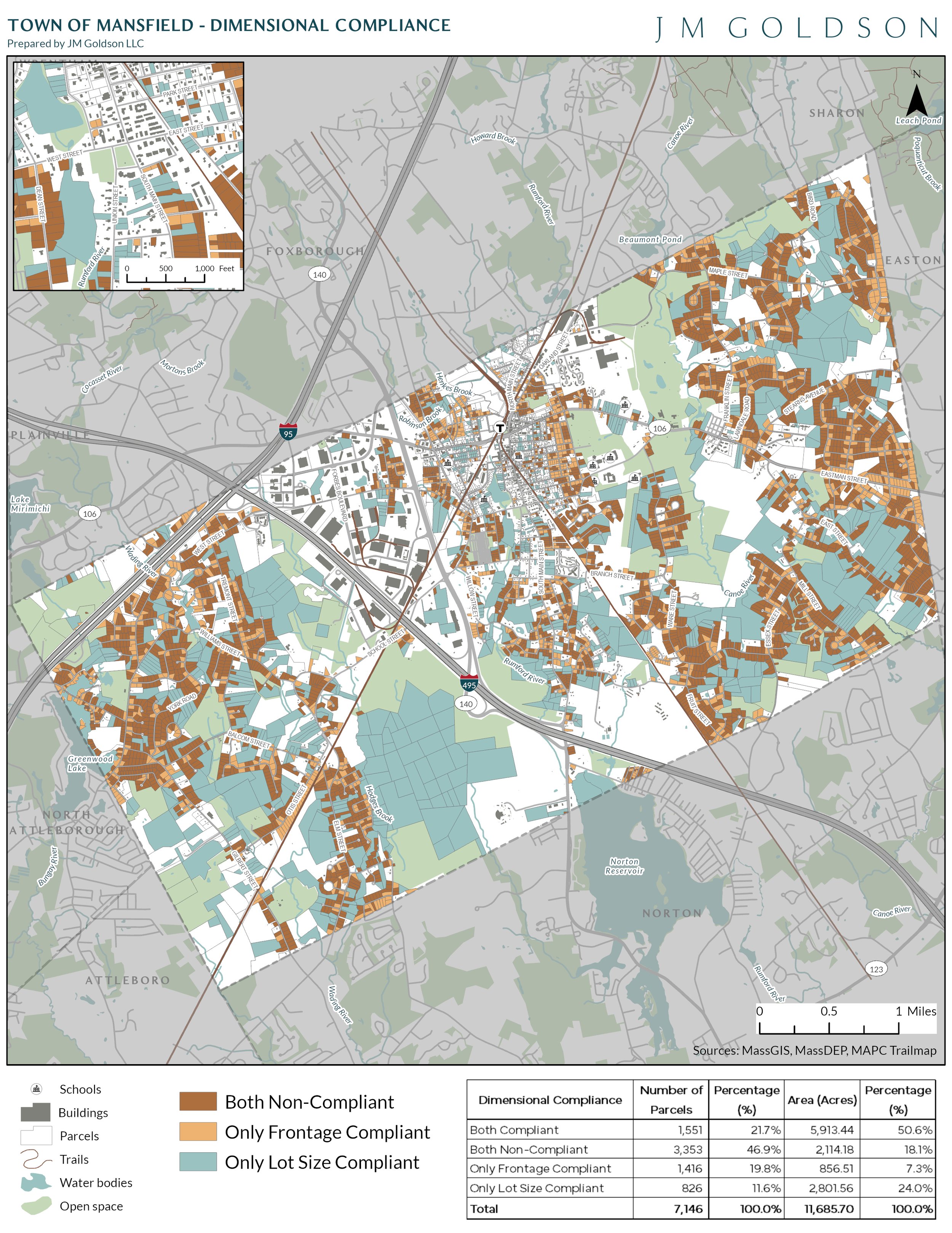
Dimensional compliance analysis of the Town of Mansfield, MA

Minimum lot size GIS model