geographic information system (GIS) mapping
Throughout my career in city planning, I have used Geographic Information Systems (GIS) to develop maps at various scales, from city-level analyses to national studies. I have worked with different types of maps, including land management, environmental, historical resource, and transportation maps, using GIS tools to visualize spatial data and support decision-making in urban planning.
What is a Geographic Information System (GIS)?
It is a tool that allows for the storage, analysis, and visualization of spatial data to understand the distribution and relationships between different elements in a given area. Through mapping, GIS facilitates geographic data analysis, helping to identify patterns, evaluate scenarios, and make informed decisions in urban planning.
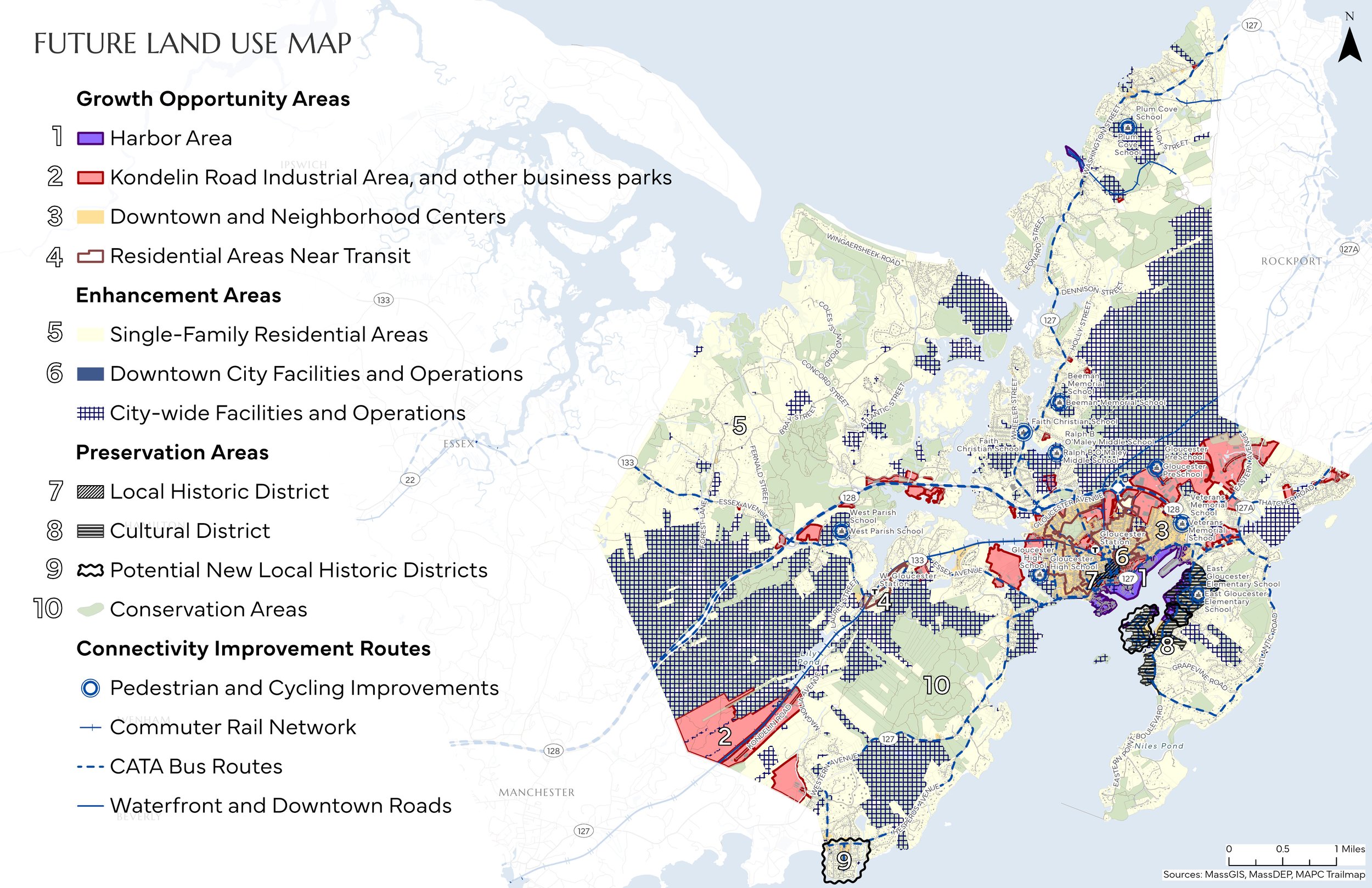
Future Land Use map of the City of Gloucester, MA
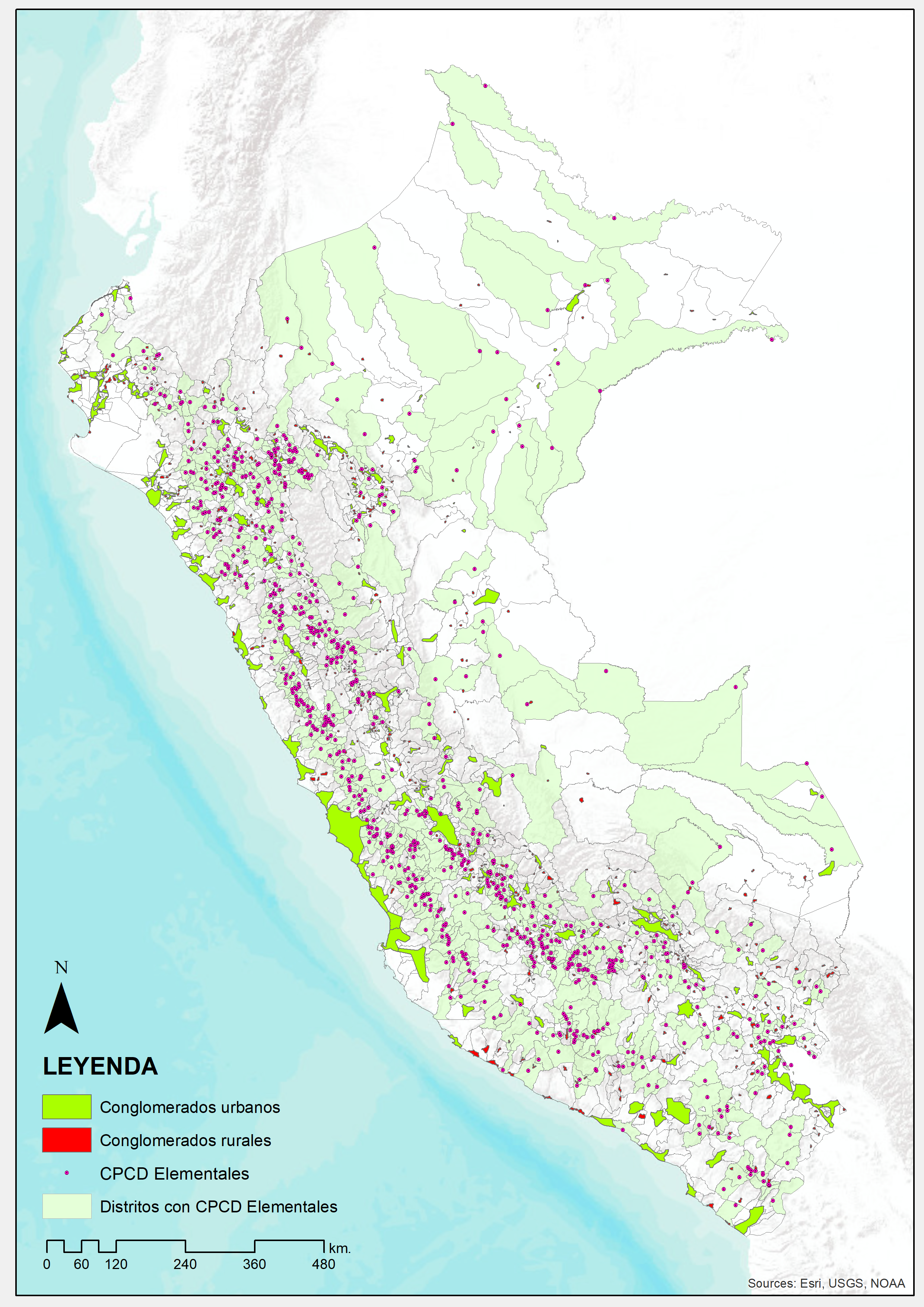
Rural settlements map of Peru
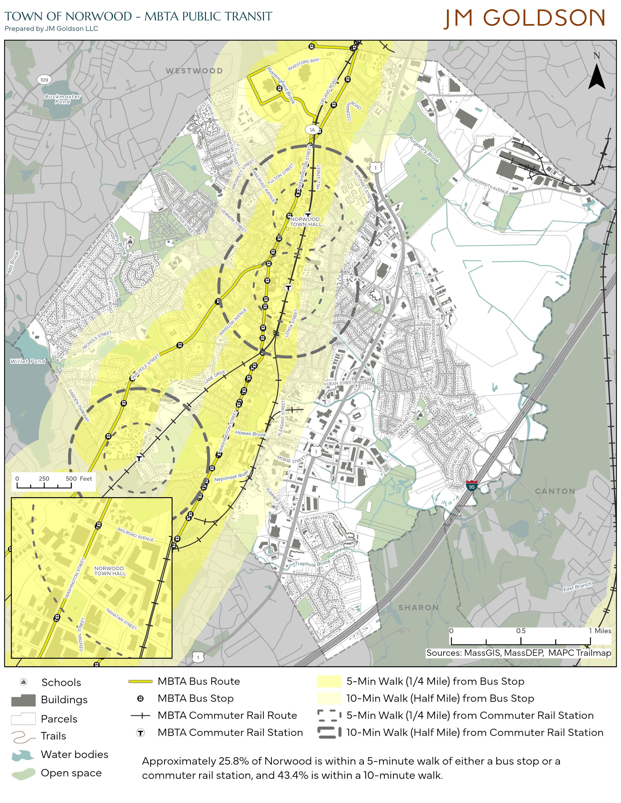
Transit access map of the Town of Norwood, MA
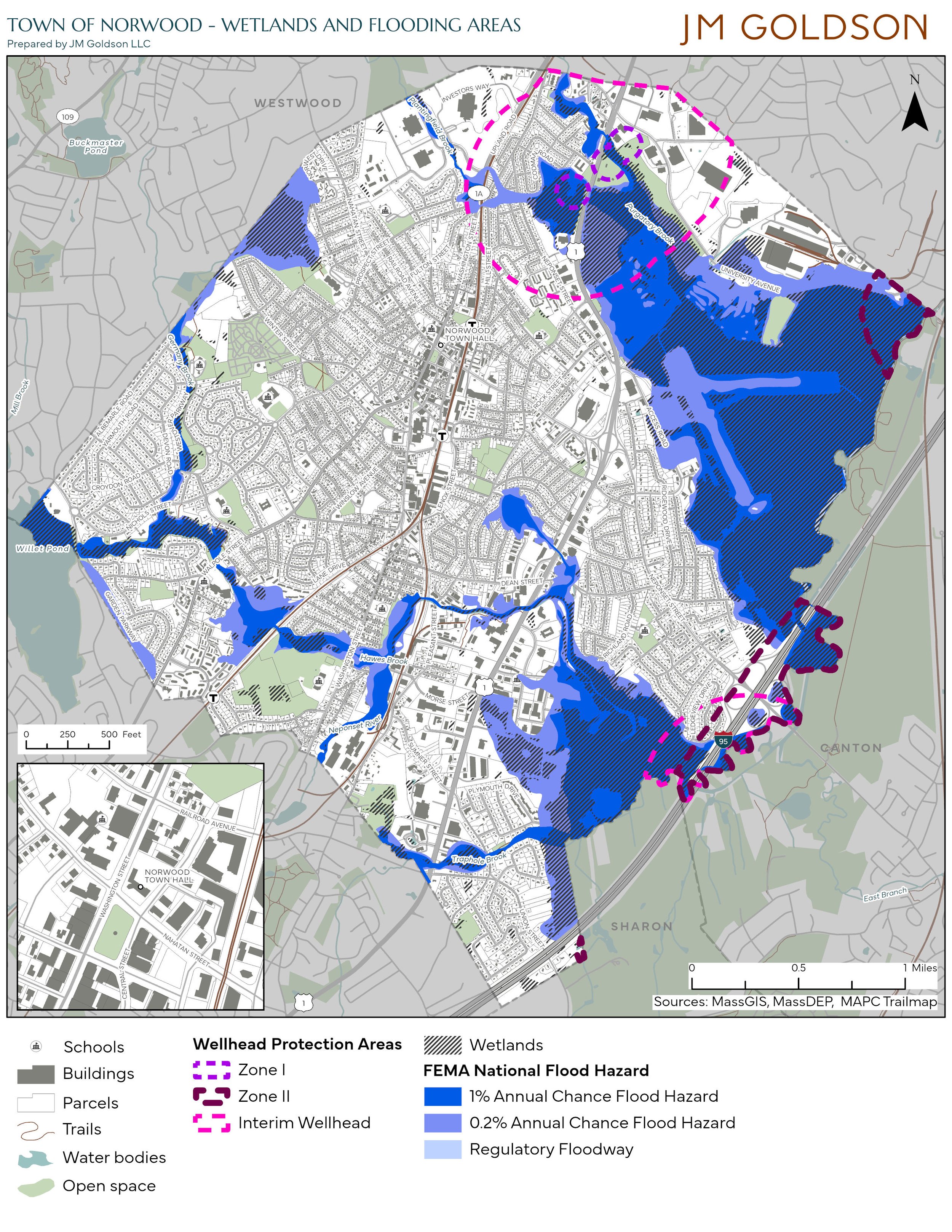
Wetlands map of the Town of Norwood, MA
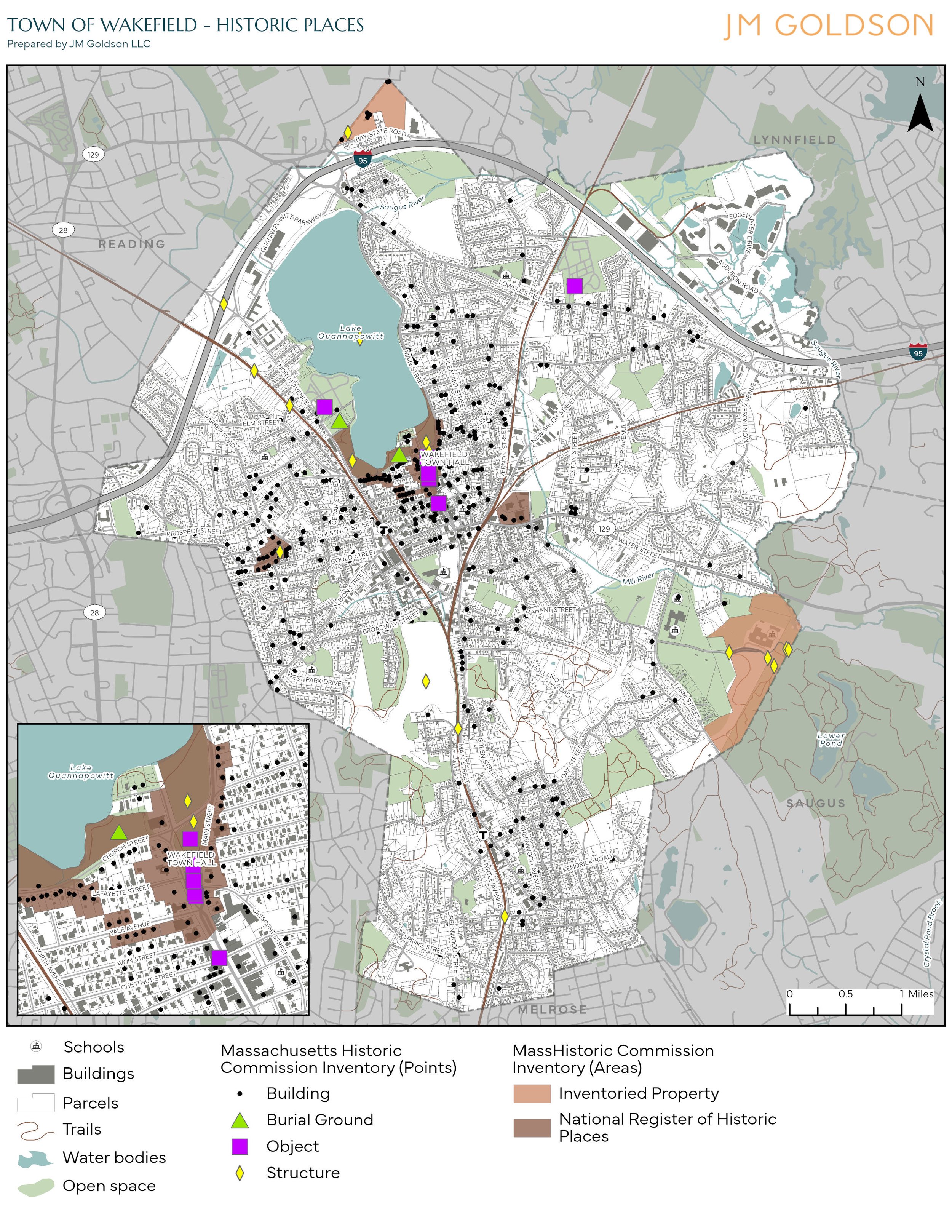
Historic resources map of the Town of Wakefield, MA